")
")
1-15 February 2024
Satellites et stratégy
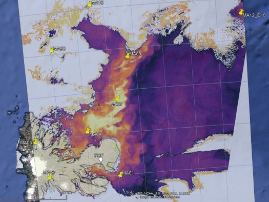
Most of the MARGOCEAN campaign took place in the north-east of the Kerguelen archipelago. The coast here is very indented and bordered by a large number of islands and islets. It is extended by a wide shallow plateau (0-300 m) which forms the link with the open sea.


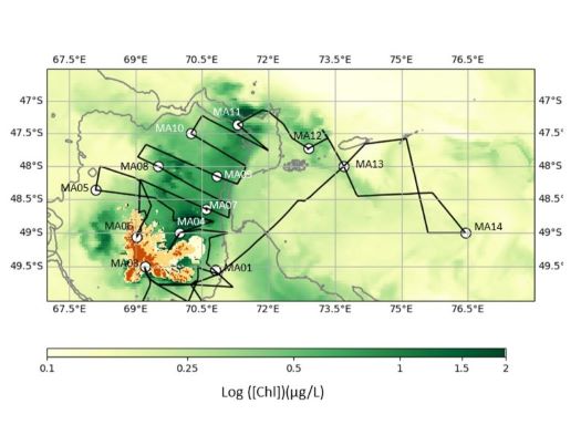
MARGOCEAN's strategy is to sample this continuum by trying to track the material emitted by melting glaciers from its source to the ocean. Satellite images have been very useful for this. They were specially prepared at the LOCEAN Laboratory in Paris using data from the Sentinel 3 satellite. When the sky is clear, it is possible to visualise the chlorophyll plume in real time with a spatial resolution of 300m. On the left is the image from 2 February 2024, which was used to accurately select the positions of stations 4, 7 and 9. At the end of the campaign, all the stations and the routes taken were superimposed on a composite satellite image representative of the campaign period (right).